![]()

![]()
TABLE OF CONTENTS:
Return to this Lesson Plan's Summary Page
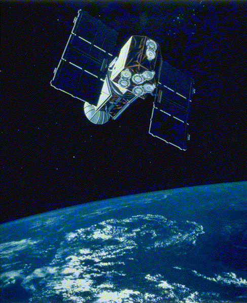
The EUVE satellite offers a wonderful opportunity for students to see a real application of math, to ask questions about how satellites stay in orbit and to see how mathematics provides a tool for analyzing information about space astrophysics satellite missions.
Return to the Table of Contents
This lesson has several objectives:
Return to the Table of Contents
Return to the Table of Contents
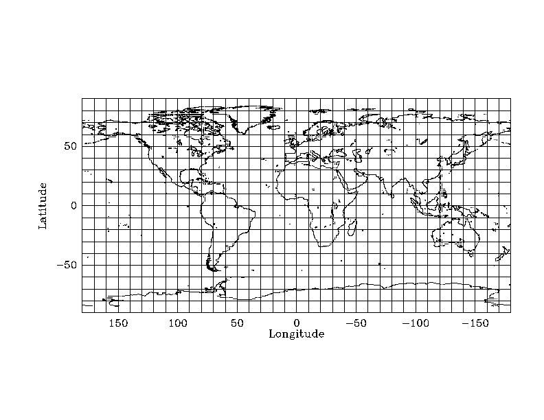
In a very visible spot in the classroom post a big color planisphere of the Earth and provide large "sticky dots" for students to plot their data. Even though the students will be plotting on their own copy of the world map, they will enjoy the process of placing a point on the class map.
This lesson will cover at least two days, but it will work best with three full days. Here is a short synopsis of the daily plans:
DAY ONE:
This day is an introduction to orbits and the EUVE satellite mission. On-line resources on the EUVE NASA satellite mission can be found in the CEA Home Page. Be sure to cover the following topics:
DAY TWO:
Have students spread around your classroom in small groups with supplies as specified above.
One of the innovative aspects of this lesson plan is that the students will be able to use an interactive feature of this lesson plan to obtain position data from the EUVE satellite.
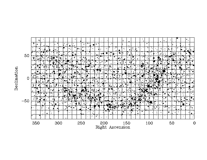
By using this interface you will access information from the EUVE satellite in the form of its position above the Earth (called the EUVE ephemeris) and in the sky against the background stars (called the EUVE orbital position).
The program computes the position of the EUVE Satellite in both terrestrial longitude and latitude (as seen from above the Earth). That is, it will give you the longitude and latitude of points on the Earth where, at certain times, the EUVE Satellite flies overhead! The program also provides points of the EUVE Satellite projected against the sky (as seen from the center of the Earth) in Right Ascension and Declination. Astronomers use Right Ascension and Declination to find their way around the sky in a similar fashion that we find out way around a map of the Earth using longitude and latitude. To use the interactive program, you may specify
The interactive tool allows students to obtain the following information as a function of time, displayed in columns:
Once the students obtain this file of data by using the interactive tool, they will then be able to use the data file produced to plot the position of the EUVE satellite projected on the Earth using this "world map." Students can also plot the position of the EUVE satellite against the background stars using this "sky map."
You may want to let your students experiment with what would be reasonable values for these parameters that they'll have to provide when using this interactive tool. For example, a student may enter his or her birthay for the current year as the starting time, in the format specified in the interactive tool (e.g. 09/02/94:00:00:00 for Sep. 2, 1994). Then, the student may choose a time step or interval of a few minutes to a few months, plot the data for 50 or 100 time steps, and figure out if his or her parameter choices are reasonable. Since the orbital period of the EUVE satellite is approximately 93 minutes, (that is, it takes EUVE 93 minutes to go once around the Earth), a reasonable choice of time interval and time unit for plotting the EUVE orbit might be every 5 to 10 minutes, plotted for 50 or 100 time steps. Let your students experiment and discover the EUVE orbital period by plotting data at several different time intervals.
Have each student in each group access the EUVE satellite's position data using the Interactive Tool. The students can plot the latitude and longitude data pairs from the output file on their world map, using the Earth's equator as the x-axis of their graph. If done properly, this graph will result in a sine curve. The same plotting procedure can be used for marking the position of the EUVE satellite in the sky projected against the background stars.
Once the students are making progress plotting the EUVE position above the Earth onto their individual copies of the world map, they can also plot their points on the big color copy of the world map that is provided for the whole classroom.
It will also be interesting for the students to compare their plots for the same time intervals that they have made on the world map against their plots on the sky map. They should find that due to the Earth's rotation, the sine curve that they plot on the world map will be compressed with respect to the sine curve they plot on the sky map.
At the end of this discovery period, the groups could write a brief report summarizing their observations and predictions for the orbit of the EUVE. Students can view a map of the world with the already-plotted real-time position of the EUVE satellite by using this lesson plan as well. To obtain a computer-generated plot of the EUVE orbit and real-time position, click here. Student groups can then compare their plotted data with the calculated position and shape of the orbit as shown by the computer-plotted map, discussing any discrepancies.
DAY THREE:
This day is best to allow groups to finish their work from the previous day. The world map in front of the class should be finished and discussed. Have the students reflect on their previous activity and discuss properties of orbits. Students should be ready to talk about periods and amplitude of sine curves, even if they are unaware of the sine function.
It might be fun to have the students figure out which countries and bodies of water the EUVE flies over. This could lead to a discussion about predicting when the EUVE satellite will be over a specific geographical location.
Return to the Table of Contents
Return to the Table of Contents
y = b cos (x - d)
Return to the Table of Contents
Return to the Table of Contents
EUVE Satellite Dataflow Demonstration, a demonstration of the communication path between the EUVE satellite and a scientist on Earth.
Take a Spin through the Solar System, an investigation of rotation rates of different planets and the Sun.
Return to the Table of Contents
Return to Teacher-Developed Earth and Space Science Lesson Plans
