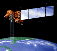
| Most people when asked think that the LANDSAT circles the earth around its middle - the Equator. However, in order to take the pictures it does, it needs to fly around the earth from pole to pole. That means it flies from around what we call the North Pole down across the Equator to near the South Pole and then back up the other side to near the North Pole and then back down and up again. |  This artist's drawing shows the LANDSAT satellite taking images of the earth. This image is from the LANDSAT Program home page |

